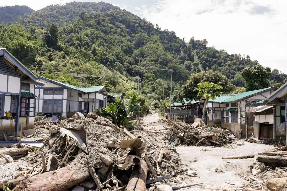
ITANAGAR, JUL 13 (PTI): Fresh floods and landslides triggered by incessant rain disrupted road connectivity and damaged public infrastructure in several districts of Arunachal Pradesh on Monday, an official statement said.
The ongoing spell of rain-triggered floods and landslides has so far claimed seven lives and left 29 people injured across the state.
At least 97,182 people have been affected by the flood in 425 villages in all 26 districts. The calamity has caused widespread damage to agriculture and public infrastructure.
A total of 541.75 hectares of crop area has been affected, while around 1,010 hectares of forest area has also been impacted.
Infrastructure losses include damage to 150 roads, 19 bridges, 21 culverts, 221 water supply systems, 58 government buildings, 156 power lines, 224 electric poles, 10 hydel projects, two hospitals and three schools. Hundreds of houses have also been damaged across the state, the statement added.
The State Emergency Operation Centre (SEOC) said heavy rainfall in the upper reaches of the Kumey River early on Monday triggered flash floods in Kurung Kumey district, causing extensive damage in Parsi-Parlo circle and Damin sub-division.
In Damin sub-division, a bridge connecting Huri and Damin was washed away, snapping road connectivity.
An Anganwadi Centre was completely damaged, while an inspection bungalow, a rice mill, churches, prayer houses and other public infrastructure sustained significant damage.
The Inspection Bungalow was inundated, a church was damaged, and a bridge connecting Pagam village was washed away, the statement said.
The floods also caused extensive damage to St Thomas School, a prominent educational institution in the area. The entire campus was submerged, damaging buildings, classrooms, teaching materials, furniture, equipment and teachers’ quarters, it said, adding that academic activities have been halted.
The flash floods severely affected transportation, public infrastructure and residential properties. The district administration is coordinating with paramilitary forces, police and other stakeholders to assess the damage and carry out relief measures. A detailed assessment is underway to ascertain the extent of the damage and identify immediate restoration requirements, the statement said.
Additional Deputy Commissioner (ADC) Nabam Tajik said that among the worst-affected areas is Huri, where the 66-metre bailey hanging bridge connecting Damin and Huri was washed away, cutting off the village from the rest of the district.
Tajik said the district administration is coordinating with Border Roads Organisation (BRO) to restore the bridge, with restoration expected to take approximately two weeks.
The flood also washed away the Luksang Valley Bridge and the recently inaugurated Hutar Valley Bridge, both under the BRO.
In addition, several Wire Rope Suspension Bridges (WRSBs) across Kumey and Tamin rivers were either damaged or washed away, disrupting connectivity to villages including Machang, Huri, Ruba, Katuk, Pagam, Pachik, Chote, Lania, Mangio, Dalang, Pachang, Nyokuriang, Pado, Yaluha, Seriang and Tawariang.
In Pakke Kessang district, a massive landslide blocked National Highway 13 near Pakro village on Monday. District officials said restoration of the affected stretch is expected to take two to three days. The district administration has advised commuters to avoid travelling on the Itanagar-Seppa Road until further notice.
In West Kameng district, a portion of the road leading to the Sela Tunnel was washed away due to heavy rainfall. Authorities have advised commuters to use the old Sela Road as an alternative route.
The Potin-Kimin Road in Papum Pare district has remained blocked since Sunday evening after a landslide near Shiv Mandir.
Flood was reported from Lower Dibang Valley and West Siang, while, heavy rainfall affected Papum Pare and Kamle and a landslide incident was reported from the Itanagar Capital Region (ICR).
In Lower Dibang Valley, the affected circles were Dambuk, Koronu and Roing.
The affected locations included Sisiri river, Dambuk, Poplung, Bizari, Chake village, Samak river, Simar Korong, Cheta Nallah and Sita Nallah.
In West Siang, the affected circles were Darak, Kamba and Yomcha and the affected villages and localities included Poyom, ADC Complex Kamba, Kesitali, Dego Kamki, NEC Farm Kamba, Siru Tali, Seri Tali, Kesi Tali, Yaki Tato, Nomu, Libu Bene, Nomuk Bagra, Nomuk Momir, Hipin Karbak and Karbak Moku.
In Papum Pare, Jote village under Sangdupota circle was affected, while Dollungmukh village under Dollungmukh circle in Kamle district also reported heavy rain-related impacts.
In the ICR, Sanglo Putung-II under Naharlagun circle was affected by a landslide.
In East Kameng, flood affected Lower Taruso Colony and Kameng Tempa under Seppa circle.